New App Will Change How Cyclists and Scooter Riders Navigate Cities
Electric scooters and bicycles usage are up. With the availability of ride-sharing companies like Bird which is located in many large cities, it is getting easier to avoid city gridlock by leaving your car at home. Now, a new partnership between Bird and Israeli navigation startup Trailze is making micro-mobility travel safer.
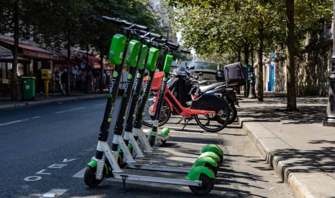
With people currently avoiding public transportation, the streets are getting very crowded with individual E-scooters and bicycles. So crowded, that major cities like London, Paris, and Tel Aviv are planning on more street closures and bike routes to make it safer to get around.
The partnership collaborated on a new way for riders to navigate urban areas with the new Bird Maps App. The application, according to Globes, is available on iOS and Android at no charge. Riders can enter where they want to go and they will receive audio and visual navigation that uses bike lanes and wider streets.
While Google Maps is great for cars, there hasn’t been an app specifically for riders of micro-mobility vehicles that aren’t surrounded by steel cages. There wasn’t a specific app for scooter riders that took their safety in consideration.
The technology that went into the app already existed in an earlier app that Trailze created for biking and hiking in Israel in 2015 according to NoCamels. Around 200,000 people downloaded it but it seemed that people still preferred paper maps. But Ronen Bitan, CEO at Trailze had a great idea to tweak this app to use it for city navigation. The result is the Bird Maps App that will be piloted in Paris and Tel Aviv beginning in July 2020, and there is already a lot of positive hype about it.
“By working with Trailze to pilot Bird Maps in Paris and Tel Aviv – two cities that have recently committed to and developed additional bike lanes – we are making it easier for riders to feel more comfortable and safe as they move about their cities without relying upon cars,” Patrick Studener, head of Bird EMEA said in a press statement.
The new app will also allow Bird to keep track of where their scooters are headed, how they are getting there, and not just where they end up.
Before the coronavirus, shared electric scooters were being used in 626 cities in 53 countries according to an EY report. With the huge growth of people using these personal vehicles during the coronavirus pandemic, a partnership between the navigation startup Trailze and Bird was a no-brainer.
“COVID19- turned a lot of people to micro-mobility for obvious reasons: people don’t want to enter shared cars or taxis anymore, deliveries are more popular and they need micro-mobility to make them cost-effective, and people saw their cities with less pollution and want it to remain clean. Micro-mobility offers great solutions,” Bitan told NoCamels.
It makes sense that this new navigation tool was developed in Israel, the navigation address for the world. Waze, the GPS navigation tool and Moovit, the travel planner, are the two most successful navigation platforms developed in Israel. Bitan hopes that Bird Maps will become the third.
The easier it becomes to use this new E-vehicle technology, the fewer cars will be on the road. That will greatly increase the livability of cities and help the environment too by reducing air pollution and carbon emissions.
